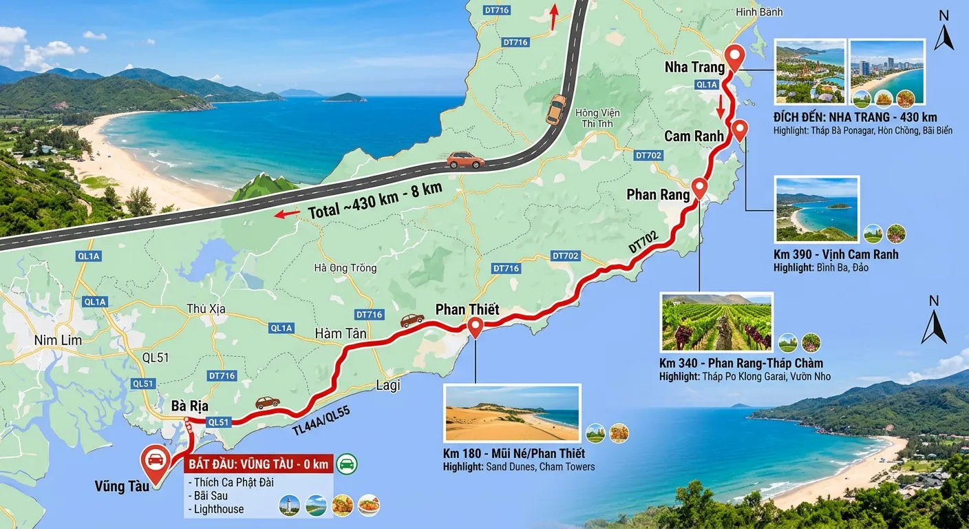
Nha Trang is about 420km from Vũng Tàu by road. Traveling by coach, the journey takes about 8–9 hours depending on stops and traffic. This article summarizes the route, stops, and tips for this long journey.
Distance & time
- Distance: about 410–420 km from central Nha Trang to central Vũng Tàu.
- Time: 8–9 hours by coach, including two rest stops.
- Route: National Highway 1 and the Vĩnh Hảo – Phan Thiết expressway to Phan Thiết; from there to Vũng Tàu depending on the bus operator, or along the coast via National Highway 55 through Hàm Tân, Bình Châu, or take the expressway and exit at Bà Rịa. Neither route requires entering downtown Ho Chi Minh City.
| Leg | Cumulative km | Time from departure |
|---|---|---|
| Phan Rang | about 105 km | 2 hours |
| Enter Vĩnh Hảo – Phan Thiết expressway | about 150 km | 2 hours 45 minutes |
| Phan Thiết | about 240 km | 4 hours 30 minutes |
| Bà Rịa | about 385 km | 7 hours 30 minutes |
| Central Vũng Tàu | about 410–420 km | 8 – 9 hours |
Route overview
The journey runs along the South Central Coast: Nha Trang → Cam Ranh → Phan Rang – Tháp Chàm (Ninh Thuận) → Cà Ná → Phan Thiết (Bình Thuận) → Bà Rịa → Vũng Tàu. Most of the trip follows National Highway 1 and sections of the North–South Expressway, helping to shorten the travel time compared to before.
Rest stops
For an 8–9 hour journey, the coach usually makes two rest stops, each lasting 15–20 minutes: once around Phan Rang – Cà Ná, and once after passing Phan Thiết. This is a good time to have a light snack, use the restroom, and stretch your legs; no food is served on the bus.
Tips for long-distance travel
- Choosing a trip: take the evening departure, sleep on the bus, and arrive in Vũng Tàu early in the morning, saving a night's hotel stay; the morning trip suits those who have trouble sleeping on the bus and want to see the Cà Ná coastal stretch.
- Choosing a seat: cabin buses have a private compartment for each passenger; choose the lower deck if you have a lot of luggage or need to get up and down frequently.
- Bring along: a light jacket (the air conditioning runs continuously), a power bank, and drinking water.
- Traveling in a group: private cars run direct and offer door-to-door pickup, usually about an hour faster than shared rides.
Fares and Go365 operating hours
| Vehicle type | Price | Departure times |
|---|---|---|
| 24-seat Cabin bus | 480.000 ₫/guest | 09:00 · 21:00 |
| Private 4-7 seat car (charter) | 3.800.000 ₫/car | Time chosen by guest |
| Private 16-seat car (charter) | 5.200.000 ₫/car | Time chosen by guest |
| Private 9-11 seat Limousine (charter) | 6.500.000 ₫/car | Time chosen by guest |
Prices and schedules are taken from the Go365 booking system, updated on 21/09/2026. Prices may change on holidays and during peak season — the amount shown at the time of booking is the final amount.
Pickup and drop-off points
Pickup in Nha Trang: 77 Thái Nguyên.
Drop-off in Bà Rịa - Vũng Tàu: Vũng Tàu bus station.
The exact pickup point depends on the trip and vehicle type you choose; for private cars, pickup is door-to-door at the address you provide when booking.
Book Nha Trang – Vũng Tàu
Departure times, vehicle types, and actual fares for this route are available on the Nha Trang to Vũng Tàu bus page on Go365 — pay in VND via 9pay or bank transfer, with 24/7 hotline support at 0789.9000.77. For the return trip, read Vũng Tàu to Nha Trang bus; for other travel options, see how to get to Vũng Tàu from Nha Trang.